Section
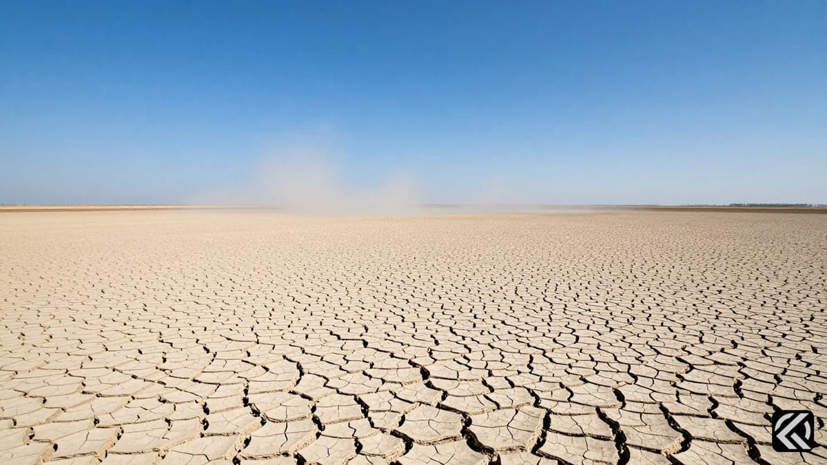
India’s monsoon progress stalls as a 35% rainfall deficit looms, sparking fears of a severe Super El Niño season and significant agricultural impact across the subcontinent.
India’s monsoon progress has stalled, leaving the nation facing a significant India monsoon deficit of 35% as of June 16, nearly a week past the normal arrival date.
Rain clouds have yet to reach Mumbai, and the shortfall is concentrated in Maharashtra, the Konkan coast, and central India, where the monsoon’s northward advance has been held back for several days.
While June rainfall deficits are common in the first month of the monsoon season, this year’s situation is particularly concerning due to global forecasts predicting a 'Super El Niño' event.
According to statistics from the India Meteorological Department (IMD), the rainfall shortfall is unevenly distributed across the country. Except for northwest India, which has received 5% more rain than normal, all other regions are experiencing deficits.
East and northeast India are down 43%, central India is down 63%, and the southern peninsula is down 14%. This disparity highlights the erratic nature of the current weather patterns, which have stalled the monsoon's typical progression.
The IMD’s all-India June rainfall departures for El Niño years since 2000 show no consistent early-season signal. In June 2015, during one of the strongest El Niño events on record, rainfall was actually 14% above normal. Similarly, June 2002 and June 2004, years that later ended in drought, recorded near-normal June rainfall.
However, sharp failures in June are rare. Only in 2009 (47% below normal) and 2014 (44% below normal) did June rainfall fail as severely as it has this year. In the most recent El Niño year, 2023, June closed about 8% below normal, which remained within the IMD’s normal range.
An El Niño event, defined as the periodic warming of the central and eastern Pacific Ocean that tends to suppress the Indian monsoon, typically establishes itself in the spring and exerts influence mainly in the middle and later parts of the season.
“June rainfall and the pace of onset, by contrast, are governed largely by local and regional factors,” according to D.S. Pai, chief forecaster at the IMD’s Regional Meteorological Centre in Chennai.
This year, the monsoon set in over Kerala on June 4, just three days behind its normal date, but its advance up the west coast has since lost momentum. Dr. Pai explained that the monsoon moves in pulses, and the first pulse, having reached the outskirts of Mumbai, did not sustain itself.
Instead, an “anticyclonic circulation” to the city’s north, combined with a westerly push from mid-latitude weather systems, has prevented the monsoon from establishing itself properly.
The Madden-Julian Oscillation, a travelling band of atmospheric activity that can strengthen or weaken the monsoon, is currently in an “unfavorable phase.” This implies that the onset over Mumbai is likely to be delayed by a further five to six days, until the next pulse strengthens, possibly aided by a low-pressure system forming over the Bay of Bengal.
The monsoon’s sluggishness also reflects a tug-of-war between the monsoon and mid-latitude weather systems. The mid-latitudes are the zone between the tropics and the poles, dominated by eastward-flowing westerly winds. Western disturbances, which are rain-bearing storms arriving from the Mediterranean and West Asia, are embedded in that flow.
“Whichever system is stronger controls the Indian region. In summer, a vigorous monsoon normally pushes the westerlies northward; in winter, the westerlies dominate and the monsoon retreats to the southern hemisphere. June is a transition between the two. Because El Niño has weakened the monsoon, it has so far been unable to push the mid-latitude systems back, allowing them to intrude further south and stall its advance,” Dr. Pai said.
A strong monsoon can interact with an incoming western disturbance to deliver heavier rain over north and northwest India, whereas a weak monsoon is simply pushed back.
The U.S. National Oceanic and Atmospheric Administration issued an El Niño advisory on June 11, confirming the event had formed and placing the odds of it becoming “very strong” by winter at 63%. The World Meteorological Organization had earlier put the probability of El Niño emerging between June and August at 80%.
The IMD’s own June bulletin states that El Niño conditions are present and that the ocean and atmosphere have coupled, with no positive Indian Ocean Dipole expected to offset it this season.
Warnings have been building for months. The IMD’s first-stage forecast in April pegged seasonal rainfall at 92% of the long-period average. Its May-end update lowered this to 90% and assigned a 60% probability to a deficient year, representing the agency’s most pessimistic pre-season call since 2015.
In response to these dire warnings, Union Agriculture Minister Shivraj Singh Chouhan chaired a review of kharif preparations on June 16. He directed States to identify districts facing low or uneven rainfall and to draw up crop-wise contingency plans, so that affected farmers could be “immediately provided with alternatives, advice, and assistance.”
The Centre has placed 150 to 200 districts under priority monitoring, ordered weekly El Niño reviews, and is encouraging a shift towards cotton and pulses. Mr. Chouhan has maintained that seed and fertiliser stocks are adequate.
Reservoir storage stands at 30.4% of capacity in May, against a 25.1% average in previous El Niño years, which Mr. Chouhan argues leaves India better placed than in earlier deficient seasons.
Despite government assurances, analysts are more cautious. The rating agency ICRA has estimated that a serious farm disruption could add about 0.4 percentage points to retail food inflation, a risk the Reserve Bank of India has flagged.
One likely fallout of Super El Niño conditions is the tightening of an already stressed fertiliser supply. India is contending with China’s curbs on di-ammonium phosphate exports, while elevated natural gas prices are feeding into the cost of domestic urea production.
These compounding factors highlight the severity of the current agricultural impact as the country navigates through an uncertain monsoon season. The interplay between global climate phenomena and local weather systems continues to pose significant challenges for food security and economic stability in the coming months.
The confluence of a stalled monsoon onset and the potential development of a very strong Super El Niño by winter presents a complex challenge for India's agricultural sector. With the government urging a shift to hardier crops like cotton and pulses, and reservoir levels marginally above historical averages for such years, the nation is attempting to mitigate the worst effects. However, the persistence of unfavorable atmospheric patterns, such as the Madden-Julian Oscillation, suggests that immediate relief in northern and western regions may remain delayed. If the forecast holds, the resulting pressure on food inflation and fertiliser supplies will likely intensify, requiring sustained vigilance and adaptive strategies from both policymakers and farmers throughout the remainder of the season.
Jun 17, 2026 00:58 UTC
US-Iran 60-Day Challenge: Peace Deal Leaves Nuclear Details Pending
Jun 16, 2026 22:51 UTC
G7 Summit: Modi Warns of Hormuz Risks, Trump Pushes Russian Sanctions
Jun 16, 2026 18:58 UTC
G7 Leaders Intensify Pressure on Russia with New Sanctions
Jun 16, 2026 18:36 UTC
Trump Claims US-Iran Agreement Opens Strait of Hormuz Without Tolls
Jun 15, 2026 10:44 UTC
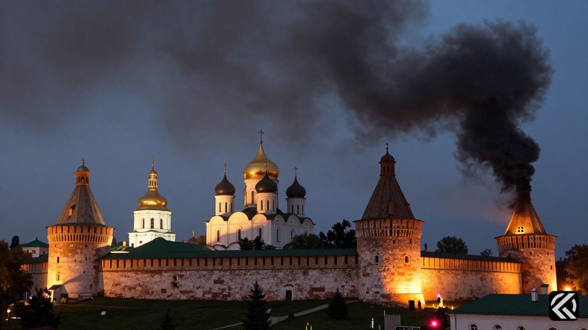
Historic Kyiv Monastery Burned Amid Massive Russian Attack